
Tommy topographic map
Interactive map
Click on the map to display elevation.
About this map
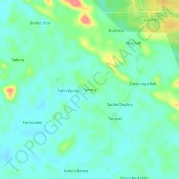
Name: Tommy topographic map, elevation, terrain.
Location: Tommy, Kakata, Margibi County, Liberia (6.61439 -10.18327 6.65439 -10.14327)
Average elevation: 110 m
Minimum elevation: 88 m
Maximum elevation: 174 m