
Rouyn-Noranda topographic map
Interactive map
Click on the map to display elevation.
About this map
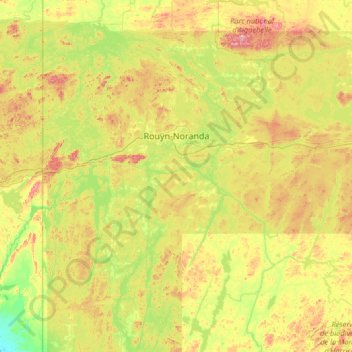
Name: Rouyn-Noranda topographic map, elevation, terrain.
Location: Rouyn-Noranda, Abitibi-Témiscamingue, Quebec, Kanada (47.70256 -79.51763 48.57496 -78.22118)
Average elevation: 307 m
Minimum elevation: 186 m
Maximum elevation: 563 m
Etwa 30 km westlich der Stadt befindet sich am Mont Kanasuta ein kleines Wintersportgebiet. Ein Sessellift und ein Skilift erschließen 16 Pisten mit einem maximalen Höhenunterschied von 147 m.