
Kastelruth - Ciastel - Castelrotto topographic map
Interactive map
Click on the map to display elevation.
About this map
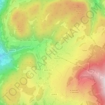
Name: Kastelruth - Ciastel - Castelrotto topographic map, elevation, terrain.
Average elevation: 1,118 m
Minimum elevation: 573 m
Maximum elevation: 1,596 m
Other topographic maps
Click on a map to view its topography, its elevation and its terrain.
Tiosels
Italy > Trentino-Alto Adige/Südtirol > South Tyrol > Kastelruth - Castelrotto > Kastelruth - Ciastel - Castelrotto > Tiosels
Tiosels, Kastelruth - Ciastel - Castelrotto, Kastelruth - Castelrotto, Salten-Schlern - Salto-Sciliar, South Tyrol, Trentino-Alto Adige/Südtirol, Italy
Average elevation: 1,275 m