
La Prairie topographic map
Interactive map
Click on the map to display elevation.
About this map
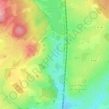
Name: La Prairie topographic map, elevation, terrain.
Average elevation: 413 m
Minimum elevation: 353 m
Maximum elevation: 482 m
Other topographic maps
Click on a map to view its topography, its elevation and its terrain.
Pre Marion
France > Bourgogne-Franche-Comté > Saint-Pierre-de-Varennes
Pre Marion, Saint-Pierre-de-Varennes, Autun, Saône-et-Loire, Bourgogne-Franche-Comté, Metropolitan France, 71670, France
Average elevation: 395 m