
Langbank topographic map
Interactive map
Click on the map to display elevation.
About this map
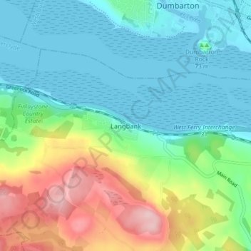
Name: Langbank topographic map, elevation, terrain.
Location: Langbank, Renfrewshire, Scotland, PA14 6YA, United Kingdom (55.90403 -4.60565 55.94403 -4.56565)
Average elevation: 56 m
Minimum elevation: -1 m
Maximum elevation: 191 m
Renfrewshire trails, hiking, mountain biking, running and outdoor activities
Other topographic maps
Click on a map to view its topography, its elevation and its terrain.