Geolocate

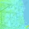
Bitano topographic map

Click on the map to display elevation.

About this map

Name: Bitano topographic map, elevation, terrain.

Location: Bitano, Legazpi, Albay, Bicol Region, 4500, Philippines (13.12868 123.72597 13.16868 123.76597)

Average elevation: 14 m

Minimum elevation: 0 m

Maximum elevation: 143 m

Other topographic maps

Click on a map to view its topography, its elevation and its terrain.
Sawangan Park

Philippines > Albay > Legazpi

Average elevation: 7 m

Tibu River

Philippines > Albay > Legazpi > Tamaoyan

Average elevation: 4 m

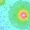
Mayon Volcano

Philippines > Albay > Legazpi

Average elevation: 519 m

Kalayaan Park

Philippines > Albay > Legazpi

Average elevation: 7 m

Gear up for your next adventure:

🧼Biodegradable Soap - Leave-no-trace hygiene for multi-day mountain treks
🔥Emergency Fire Starters - Reliable ignition tools for survival situations in damp conditions
🛌Sleeping Mats - Insulated mats for comfortable outdoor sleeping
📻Hand-Crank Emergency Radios - Stay updated on weather warnings in remote areas
🧥Softshell Jackets - Breathable jackets for active outdoor use

As an Amazon Associate, this site earns from qualifying purchases at no extra cost to you.