
Make a donation
Gear up for your next adventure:
As an Amazon Associate, this site earns from qualifying purchases at no extra cost to you.
Isla Watson topographic map
Click on the map to display elevation.
Make a donation
Gear up for your next adventure:
As an Amazon Associate, this site earns from qualifying purchases at no extra cost to you.
About this map
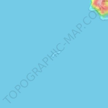
Name: Isla Watson topographic map, elevation, terrain.
Average elevation: 3 m
Minimum elevation: 0 m
Maximum elevation: 207 m
Make a donation
Gear up for your next adventure:
As an Amazon Associate, this site earns from qualifying purchases at no extra cost to you.
Other topographic maps
Click on a map to view its topography, its elevation and its terrain.
Parroquia Puerto Baquerizo Moreno
Ecuador > Galápagos > Cantón San Cristóbal
Puerto Baquerizo Moreno is the capital and administrative centre of Ecuador's Galápagos Province. It is located on the southwestern coast of San Cristóbal, and the town is also nicknamed Cristóbal by the local people, after the island. Its average elevation is 6 metres (20 ft). The central part of the town,…
Average elevation: 35 m
Make a donation
Gear up for your next adventure:
As an Amazon Associate, this site earns from qualifying purchases at no extra cost to you.
Punta Chacabuco
Ecuador > Galápagos > Cantón San Cristóbal > Parroquia Puerto Baquerizo Moreno
Average elevation: 12 m