
Melverley topographic map
Interactive map
Click on the map to display elevation.
About this map
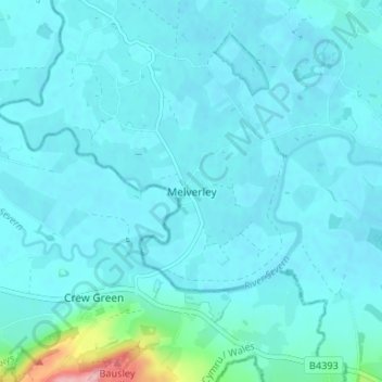
Name: Melverley topographic map, elevation, terrain.
Average elevation: 67 m
Minimum elevation: 54 m
Maximum elevation: 195 m
Other topographic maps
Click on a map to view its topography, its elevation and its terrain.
Ponthen
United Kingdom > England > Shropshire > Melverley
Ponthen, Melverley, Shropshire, England, SY10 8PN, United Kingdom
Average elevation: 62 m
Melverley Green
United Kingdom > England > Shropshire > Melverley > Melverley Green
Melverley Green, Melverley, Shropshire, West Midlands, England, SY10 8PH, United Kingdom
Average elevation: 60 m