
Thank you for supporting this site ❤️
Make a donation
Make a donation
Gear up for your next adventure:
As an Amazon Associate, this site earns from qualifying purchases at no extra cost to you.
Valdivelo topographic map
Click on the map to display elevation.
Thank you for supporting this site ❤️
Make a donation
Make a donation
Gear up for your next adventure:
As an Amazon Associate, this site earns from qualifying purchases at no extra cost to you.
About this map
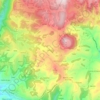
Name: Valdivelo topographic map, elevation, terrain.
Location: Valdivelo, Velo Veronese, Verona, Veneto, 37028, Italia (45.58950 11.07010 45.62950 11.11010)
Average elevation: 1,024 m
Minimum elevation: 750 m
Maximum elevation: 1,257 m
Thank you for supporting this site ❤️
Make a donation
Make a donation
Gear up for your next adventure:
As an Amazon Associate, this site earns from qualifying purchases at no extra cost to you.