
Castelletto topographic map
Interactive map
Click on the map to display elevation.
About this map
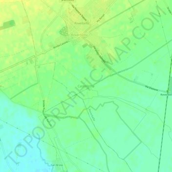
Name: Castelletto topographic map, elevation, terrain.
Location: Castelletto, Roverbella, Mantoue, Lombardie, 46048, Italie (45.23385 10.74973 45.27385 10.78973)
Average elevation: 38 m
Minimum elevation: 28 m
Maximum elevation: 48 m
Other topographic maps
Click on a map to view its topography, its elevation and its terrain.
Castiglione delle Stiviere
Castiglione delle Stiviere, Mantoue, Lombardie, 46043, Italie
Average elevation: 95 m