
Thank you for supporting this site ❤️
Make a donation
Make a donation
Gear up for your next adventure:
As an Amazon Associate, this site earns from qualifying purchases at no extra cost to you.
Puram topographic map
Click on the map to display elevation.
Thank you for supporting this site ❤️
Make a donation
Make a donation
Gear up for your next adventure:
As an Amazon Associate, this site earns from qualifying purchases at no extra cost to you.
About this map
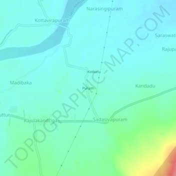
Name: Puram topographic map, elevation, terrain.
Location: Puram, Sadasivapuram, Yerpedu, Tirupati, Andhra Pradesh, India (13.62062 79.59405 13.66062 79.63405)
Average elevation: 93 m
Minimum elevation: 78 m
Maximum elevation: 151 m
Thank you for supporting this site ❤️
Make a donation
Make a donation
Gear up for your next adventure:
As an Amazon Associate, this site earns from qualifying purchases at no extra cost to you.