
La Costa topographic map
Interactive map
Click on the map to display elevation.
About this map
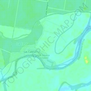
Name: La Costa topographic map, elevation, terrain.
Location: La Costa, Departamento General Roca, RN, Argentina (-39.08996 -67.56588 -39.06896 -67.53019)
Average elevation: 229 m
Minimum elevation: 223 m
Maximum elevation: 244 m
Other topographic maps
Click on a map to view its topography, its elevation and its terrain.
Bajo San Cayetano
Argentina > RN > Bajo San Cayetano
Bajo San Cayetano, Departamento General Roca, RN, Argentina
Average elevation: 278 m