
Cañada DE LOZOYA. GARGANTILLA DEL LOZOYA topographic map
Interactive map
Click on the map to display elevation.
About this map
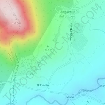
Name: Cañada DE LOZOYA. GARGANTILLA DEL LOZOYA topographic map, elevation, terrain.
Average elevation: 1,142 m
Minimum elevation: 1,013 m
Maximum elevation: 1,511 m