Geolocate

Laa topographic map

Click on the map to display elevation.

About this map

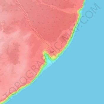
Name: Laa topographic map, elevation, terrain.

Location: Laa, Eyl District, Nugaal, Puntland, Somalia (8.17293 50.10120 8.21293 50.14120)

Average elevation: 54 m

Minimum elevation: 0 m

Maximum elevation: 115 m

Gear up for your next adventure:

🧵Survival Paracord - Multi-purpose cordage for emergency repairs and shelters
🧴Sport Sunscreen Sticks - High-protection sunblock that won't run into your eyes on the trail
🧢Waterproof Hiking Hats - Keep the rain off your face while studying topographic maps
🐕Dog Hiking Gear - Equipment for hiking safely with dogs
🧤Thermal Touchscreen Gloves - Stay warm while operating your GPS or smartphone camera

As an Amazon Associate, this site earns from qualifying purchases at no extra cost to you.