
Bel-Air topographic map
Interactive map
Click on the map to display elevation.
About this map
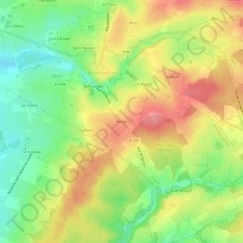
Name: Bel-Air topographic map, elevation, terrain.
Average elevation: 267 m
Minimum elevation: 220 m
Maximum elevation: 314 m
Other topographic maps
Click on a map to view its topography, its elevation and its terrain.
Saint-Léger
France > Bourgogne-Franche-Comté > Saône-et-Loire > Bourbon-Lancy
Saint-Léger, Bourbon-Lancy, Charolles, Saône-et-Loire, Bourgogne-Franche-Comté, France métropolitaine, 71140, France
Average elevation: 261 m
Sornat
France > Bourgogne-Franche-Comté > Saône-et-Loire > Bourbon-Lancy
Sornat, Bourbon-Lancy, Charolles, Saône-et-Loire, Bourgogne-Franche-Comté, France métropolitaine, 71140, France
Average elevation: 228 m