
Talbot River topographic map
Interactive map
Click on the map to display elevation.
About this map
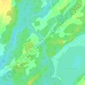
Name: Talbot River topographic map, elevation, terrain.
Location: Talbot River, Kawartha Lakes, Ontario, K0M 2B0, Canada (44.62183 -78.93320 44.63230 -78.91990)
Average elevation: 262 m
Minimum elevation: 252 m
Maximum elevation: 277 m