
Gertwiller topographic map
Interactive map
Click on the map to display elevation.
About this map
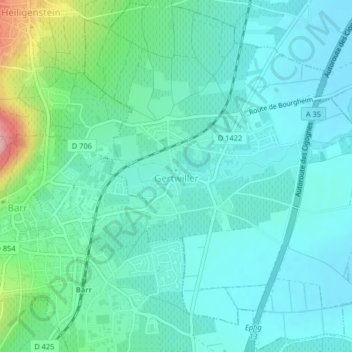
Name: Gertwiller topographic map, elevation, terrain.
Average elevation: 197 m
Minimum elevation: 165 m
Maximum elevation: 322 m
Other topographic maps
Click on a map to view its topography, its elevation and its terrain.
Lichtenberg
Francia > Grande Est > Basso-Reno > Lichtenberg
Lichtenberg, Saverne, Basso-Reno, Grande Est, Francia metropolitana, 67340, Francia
Average elevation: 279 m
Strasburgo
Francia > Grande Est > Basso-Reno
Strasburgo, Basso-Reno, Grande Est, Francia metropolitana, Francia
Average elevation: 144 m