Geolocate

Tanarrio topographic map

Click on the map to display elevation.

About this map
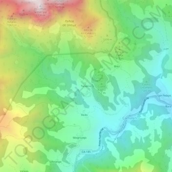
Name: Tanarrio topographic map, elevation, terrain.

Location: Tanarrio, Camaleño, Cantabria, 39587, Spain (43.13825 -4.72810 43.17825 -4.68810)

Average elevation: 810 m

Minimum elevation: 381 m

Maximum elevation: 1,688 m

Gear up for your next adventure:

📦Dry Bags - Waterproof bags to protect gear from rain
🥤Hiking Water Bottles - Reusable bottles for hydration on the trail
🧤Thermal Touchscreen Gloves - Stay warm while operating your GPS or smartphone camera
🎒Hiking Child Carriers - Explore the outdoors with the whole family safely
🗺️Scratch-off Peak Maps - Track your progress climbing Munros or Wainwrights

As an Amazon Associate, this site earns from qualifying purchases at no extra cost to you.