Geolocate

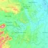
Iba topographic map

Click on the map to display elevation.

About this map

Name: Iba topographic map, elevation, terrain.

Location: Iba, San Jose, Tarlac, Central Luzon, Philippines (15.43319 120.38828 15.47319 120.42828)

Average elevation: 145 m

Minimum elevation: 91 m

Maximum elevation: 499 m

Other topographic maps

Click on a map to view its topography, its elevation and its terrain.
Bulsa River

Philippines > Tarlac > San Jose

Average elevation: 99 m

Gear up for your next adventure:

🧺Ultralight Dry Bags - Organize and waterproof your gear inside your rucksack
🚲Cycling GPS Computers - Track elevation and topographic routes on two wheels
🦟Anti-Midge & Tick Repellent - Vital for hiking in the Scottish Highlands during summer
⛺Camping Shelters - Emergency and lightweight shelters for outdoor use
🧵Survival Paracord - Multi-purpose cordage for emergency repairs and shelters

As an Amazon Associate, this site earns from qualifying purchases at no extra cost to you.