Geolocate

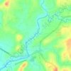
Lumbangan topographic map

Click on the map to display elevation.

About this map

Name: Lumbangan topographic map, elevation, terrain.

Location: Lumbangan, Tuy, Batangas, Calabarzon, Philippines (14.00448 120.69497 14.04448 120.73497)

Average elevation: 68 m

Minimum elevation: 25 m

Maximum elevation: 106 m

Other topographic maps

Click on a map to view its topography, its elevation and its terrain.
Luna

Philippines > Batangas > Tuy

Average elevation: 75 m

Palico River

Philippines > Batangas > Tuy > Sabang > Palico

Average elevation: 40 m

Gear up for your next adventure:

🪓Outdoor Multitools - Versatile tools for hiking and camping
🖼️Topographic Map Art - Decorative 3D-effect posters of famous UK peaks and regions
🛰️Handheld GPS Devices - Reliable GPS units for hiking and outdoor navigation
🧘Folding Sit Mats - Dry and warm seat for map-reading breaks on damp ground
👖Hiking Trousers - Durable trousers designed for rough terrain

As an Amazon Associate, this site earns from qualifying purchases at no extra cost to you.