Geolocate

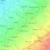
Bulusari topographic map

Click on the map to display elevation.

About this map

Name: Bulusari topographic map, elevation, terrain.

Location: Bulusari, Tarokan, Kediri Regency, East Java, 64151, Indonesia (-7.76123 111.92613 -7.72123 111.96613)

Average elevation: 92 m

Minimum elevation: 56 m

Maximum elevation: 192 m

Other topographic maps

Click on a map to view its topography, its elevation and its terrain.

Karangpakis

Indonesia > East Java > Kediri Regency > Purwoasri

Average elevation: 48 m

Kranggan

Indonesia > East Java > Kediri Regency > Gurah

Average elevation: 96 m

Kayen Kidul

Indonesia > East Java > Kediri Regency

Average elevation: 82 m

Mranggen

Indonesia > East Java > Kediri Regency > Purwoasri

Average elevation: 48 m

Pare

Indonesia > East Java > Kediri Regency

Average elevation: 166 m

Purwoasri

Indonesia > East Java > Kediri Regency

Average elevation: 48 m

Pagu

Indonesia > East Java > Kediri Regency

Average elevation: 82 m

Muneng

Indonesia > East Java > Kediri Regency > Purwoasri

Average elevation: 46 m

Grogol

Indonesia > East Java > Kediri Regency

Average elevation: 160 m

Purwoasri

Indonesia > East Java > Kediri Regency

Average elevation: 48 m

Pare

Indonesia > East Java > Kediri Regency

Average elevation: 166 m

Gear up for your next adventure:

🧢Waterproof Hiking Hats - Keep the rain off your face while studying topographic maps
🛌Sleeping Mats - Insulated mats for comfortable outdoor sleeping
🧼Biodegradable Soap - Leave-no-trace hygiene for multi-day mountain treks
👟Waterproof Leg Gaiters - Keep mud and water out of your boots in boggy terrain
🍲Portable Camping Stoves - Fast-boiling stoves for hot meals on remote topographic survey trips

As an Amazon Associate, this site earns from qualifying purchases at no extra cost to you.