Geolocate

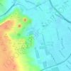
Al Ayyat topographic map

Click on the map to display elevation.

About this map

Name: Al Ayyat topographic map, elevation, terrain.

Location: Al Ayyat, Aj Jiza, 12929, Egypt (29.57958 31.21813 29.65958 31.29813)

Average elevation: 24 m

Minimum elevation: 9 m

Maximum elevation: 52 m

Other topographic maps

Click on a map to view its topography, its elevation and its terrain.

Al Ayat City

Egypt > Aj Jiza

Average elevation: 23 m

Geziret el Dahab

Egypt > Aj Jiza > Giza

Average elevation: 23 m

Nazlet Al Siman and Al Sisi

Egypt > Aj Jiza > Giza

Average elevation: 42 m

Memphis

Egypt > Aj Jiza > Mit Rahinah

Average elevation: 23 m

Gear up for your next adventure:

🥾Men's Waterproof Hiking Boots - Durable footwear with deep lugs for muddy and rocky UK terrains
🔦Keychain LED Torches - Emergency backup light for finding gear in your pack
🧺Microfibre Travel Towels - Fast-drying and compact towels for wild swimming and camping
🔋Solar Power Banks - Keep your GPS and phone charged during multi-day expeditions
🔦LED Camping Lanterns - Illumination for reading maps inside your tent at night

As an Amazon Associate, this site earns from qualifying purchases at no extra cost to you.