Geolocate

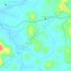
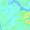
Perambra topographic map

Click on the map to display elevation.

About this map

Name: Perambra topographic map, elevation, terrain.

Location: Perambra, Koyilandi, Kozhikode, Kerala, 673525, India (11.51973 75.71812 11.59973 75.79812)

Average elevation: 27 m

Minimum elevation: 2 m

Maximum elevation: 139 m

Other topographic maps

Click on a map to view its topography, its elevation and its terrain.
Kayanna

India > Kerala > Koyilandi > Kayanna Bazar

Average elevation: 67 m

vayalada

India > Kerala > Koyilandi > Vattachira

Average elevation: 214 m

Moodadi

India > Kerala > Koyilandi > Thikkodi

Average elevation: 10 m

Balussery

India > Kerala > Koyilandi > Balusseri

Average elevation: 39 m

Kariyathumpara

India > Kerala > Koyilandi > Vallayil Thazhe

Average elevation: 543 m

Malabar WLS

India > Kerala > Koyilandi > Vythiri

Average elevation: 932 m

Kuttiyadi river

India > Kerala > Koyilandi > Peruvannamuzhi

Average elevation: 112 m

Balussery

India > Kerala > Koyilandi > Panayi

Average elevation: 39 m

Unnikulam

India > Kerala > Koyilandi > Karumala

Average elevation: 52 m

Gear up for your next adventure:

🧢Waterproof Hiking Hats - Keep the rain off your face while studying topographic maps
🛰️Handheld GPS Devices - Reliable GPS units for hiking and outdoor navigation
🪓Outdoor Multitools - Versatile tools for hiking and camping
🧢Thermal Beanie Hats - Prevent heat loss from the head in windy summit conditions
🧭Orienteering Compasses - Accurate compasses for map-based navigation

As an Amazon Associate, this site earns from qualifying purchases at no extra cost to you.