Geolocate

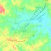
Browder topographic map

Click on the map to display elevation.

About this map

Name: Browder topographic map, elevation, terrain.

Location: Browder, Muhlenberg County, Kentucky, 42337, United States (37.17726 -87.05638 37.21726 -87.01638)

Average elevation: 141 m

Minimum elevation: 121 m

Maximum elevation: 178 m

Other topographic maps

Click on a map to view its topography, its elevation and its terrain.

Drakesboro

United States > Kentucky > Muhlenberg County

Average elevation: 131 m

Greenville

United States > Kentucky > Muhlenberg County

Average elevation: 149 m

Gear up for your next adventure:

🧴Tick Removal Tools - Small, essential health tool for UK woodland and moorland
🧭GPS Trackers - Tracking devices for safety and navigation
🗺️Ordnance Survey Maps - Essential paper maps for hiking across the UK national parks
🥾Hiking Boot Waterproofing Wax - Maintain the lifespan of your leather trekking boots
🧭Emergency Beacons - Safety beacons for remote outdoor locations

As an Amazon Associate, this site earns from qualifying purchases at no extra cost to you.