
Lac Raoul topographic map
Interactive map
Click on the map to display elevation.
About this map
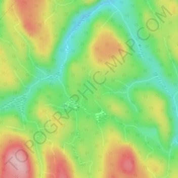
Name: Lac Raoul topographic map, elevation, terrain.
Average elevation: 443 m
Minimum elevation: 360 m
Maximum elevation: 546 m
Other topographic maps
Click on a map to view its topography, its elevation and its terrain.
Cap Trinité
Canada > Québec > Rivière-Éternité > Rivière-Éternité
Cap Trinité, Rivière-Éternité, Le Fjord-du-Saguenay, Saguenay - Lac-Saint-Jean, Québec, Canada
Average elevation: 68 m
Cap Éternité
Canada > Québec > Rivière-Éternité > Rivière-Éternité
Cap Éternité, Rivière-Éternité, Le Fjord-du-Saguenay, Saguenay - Lac-Saint-Jean, Québec, Canada
Average elevation: 101 m