
Mattawan topographic map
Click on the map to display elevation.
About this map
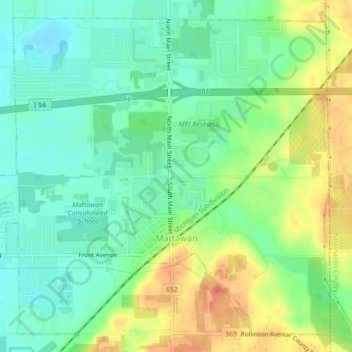
Name: Mattawan topographic map, elevation, terrain.
Location: Mattawan, Van Buren County, Michigan, 49071, United States (42.20054 -85.80919 42.22987 -85.76527)
Average elevation: 263 m
Minimum elevation: 243 m
Maximum elevation: 294 m
Other topographic maps
Click on a map to view its topography, its elevation and its terrain.
Christie Lake
United States > Michigan > Van Buren County > Lawrence Township
Average elevation: 238 m
Maple Grove Corners
United States > Michigan > Van Buren County > South Haven Charter Township
Average elevation: 197 m