Geolocate

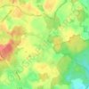
23744 topographic map

Click on the map to display elevation.

About this map

Name: 23744 topographic map, elevation, terrain.

Location: 23744, Schönwalde am Bungsberg, Ostholstein-Mitte, Kreis Ostholstein, Schleswig-Holstein, Deutschland (54.15518 10.69890 54.23481 10.83128)

Average elevation: 86 m

Minimum elevation: 9 m

Maximum elevation: 165 m

Other topographic maps

Click on a map to view its topography, its elevation and its terrain.
Gear up for your next adventure:

🧼Technical Clothing Wash - Special soap to clean and restore waterproof membranes
🔦Head Torches - Hands-free lighting for hiking and camping
🦯Walking Poles - Supportive poles for long-distance walking
🧤Waterproof Overmitts - Extreme weather protection for hikers and mountaineers
🧰Survival Kits - Emergency tools for remote environments

As an Amazon Associate, this site earns from qualifying purchases at no extra cost to you.