
Geilich topographic map
Interactive map
Click on the map to display elevation.
About this map
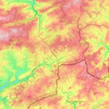
Name: Geilich topographic map, elevation, terrain.
Location: Geilich, Bastogne, Luxemburg, Wallonien, Belgien (50.11023 5.78809 50.27034 6.03439)
Average elevation: 483 m
Minimum elevation: 354 m
Maximum elevation: 599 m
Other topographic maps
Click on a map to view its topography, its elevation and its terrain.
Cobreville
Belgien > Luxemburg > Bastogne
Cobreville, Nives, Vaux-sur-Sûre, Bastogne, Luxemburg, Wallonien, 6640, Belgien
Average elevation: 455 m