Geolocate

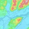
Dewdney topographic map

Click on the map to display elevation.

About this map

Name: Dewdney topographic map, elevation, terrain.

Location: Dewdney, Area G (Deroche/Dewdney/Sumas Mountain), Fraser Valley Regional District, British Columbia, V2V 7K6, Canada (49.14414 -122.21600 49.18414 -122.17600)

Average elevation: 72 m

Minimum elevation: -1 m

Maximum elevation: 829 m

Other topographic maps

Click on a map to view its topography, its elevation and its terrain.
Gear up for your next adventure:

🛰️Handheld GPS Devices - Reliable GPS units for hiking and outdoor navigation
🍱Food Containers - Reusable containers for outdoor meals
👟Waterproof Leg Gaiters - Keep mud and water out of your boots in boggy terrain
⌚GPS Outdoor Watches - Watches with GPS tracking for hiking and exploration
🧭GPS Trackers - Tracking devices for safety and navigation

As an Amazon Associate, this site earns from qualifying purchases at no extra cost to you.