
Make a donation
Gear up for your next adventure:
As an Amazon Associate, this site earns from qualifying purchases at no extra cost to you.
Babati topographic map
Click on the map to display elevation.
Make a donation
Gear up for your next adventure:
As an Amazon Associate, this site earns from qualifying purchases at no extra cost to you.
Babati
Babati town has developed from a mere village since Babati District was established in 1985. The new status boosted the town into rapid growth. The town is located at an altitude of 2,145 metres or 7,037 feet near the end of Tarangire National Park and the base of Lake Babati, nestling under Mount Kwaraha.
Make a donation
Gear up for your next adventure:
As an Amazon Associate, this site earns from qualifying purchases at no extra cost to you.
About this map
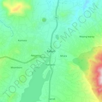
Name: Babati topographic map, elevation, terrain.
Average elevation: 1,392 m
Minimum elevation: 1,206 m
Maximum elevation: 1,963 m
Make a donation
Gear up for your next adventure:
As an Amazon Associate, this site earns from qualifying purchases at no extra cost to you.