
Saverne topographic map
Interactive map
Click on the map to display elevation.
About this map
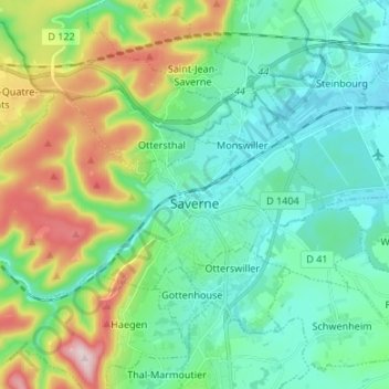
Name: Saverne topographic map, elevation, terrain.
Location: Saverne, Bas-Rhin, Grand Est, Metropolitan France, 67700, France (48.72043 7.28663 48.76741 7.42042)
Average elevation: 265 m
Minimum elevation: 169 m
Maximum elevation: 532 m
Other topographic maps
Click on a map to view its topography, its elevation and its terrain.
Quartier des Aviateurs
France > Grand Est > Bas-Rhin > Sélestat > Quartier des Aviateurs
Average elevation: 175 m