Geolocate

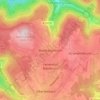
Billigheim topographic map

Click on the map to display elevation.

About this map

Name: Billigheim topographic map, elevation, terrain.

Location: Billigheim, GVV Schefflenztal, Neckar-Odenwald-Kreis, Baden-Württemberg, 74842, Germany (49.29739 9.17867 49.38170 9.31531)

Average elevation: 291 m

Minimum elevation: 165 m

Maximum elevation: 364 m

Other topographic maps

Click on a map to view its topography, its elevation and its terrain.
Gear up for your next adventure:

🪢Paracord - Multi-purpose cord for camping and survival
🛰️Satellite Messengers - Emergency communication devices for areas without mobile signal
🦶Anti-Blister Balms - Protect your feet before long topographic expeditions
👕Technical Hiking Tees - Moisture-management for high-exertion climbs
🧷Tenacious Repair Tape - Instant fix for torn tents, jackets, or dry bags

As an Amazon Associate, this site earns from qualifying purchases at no extra cost to you.