Geolocate

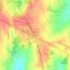
Fairfield topographic map

Click on the map to display elevation.

About this map

Name: Fairfield topographic map, elevation, terrain.

Location: Fairfield, Butler County, Ohio, 45014, United States (39.30147 -84.62992 39.36679 -84.47683)

Average elevation: 213 m

Minimum elevation: 158 m

Maximum elevation: 311 m

Other topographic maps

Click on a map to view its topography, its elevation and its terrain.

South Highlands

United States > Ohio > Butler County > Middletown

Average elevation: 214 m

Shandon

United States > Ohio > Butler County

Average elevation: 203 m

Busenbark

United States > Ohio > Butler County

Average elevation: 202 m

Hughes

United States > Ohio > Butler County

Average elevation: 237 m

Maud

United States > Ohio > Butler County

Average elevation: 253 m

Oakland

United States > Ohio > Butler County > Middletown

Average elevation: 202 m

Williamsdale

United States > Ohio > Butler County

Average elevation: 193 m

McGonigle

United States > Ohio > Butler County

Average elevation: 266 m

Astoria

United States > Ohio > Butler County

Average elevation: 263 m

Gear up for your next adventure:

🥾Hiking Boot Waterproofing Wax - Maintain the lifespan of your leather trekking boots
🔭Compact Hiking Binoculars - Lightweight optics for scouting terrain and spotting wildlife
📚UK Hiking Guidebooks - Detailed route descriptions for the Lake District, Peaks, and Highlands
🎒Hiking Child Carriers - Explore the outdoors with the whole family safely
🍲Portable Camping Stoves - Fast-boiling stoves for hot meals on remote topographic survey trips

As an Amazon Associate, this site earns from qualifying purchases at no extra cost to you.