Geolocate

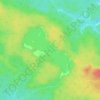
Bea Lake topographic map

Click on the map to display elevation.

About this map

Name: Bea Lake topographic map, elevation, terrain.

Location: Bea Lake, Unorganized North Cochrane, Cochrane District, Northeastern Ontario, Ontario, Canada (48.34463 -79.86800 48.34654 -79.86406)

Average elevation: 348 m

Minimum elevation: 324 m

Maximum elevation: 369 m

Other topographic maps

Click on a map to view its topography, its elevation and its terrain.

Gear up for your next adventure:

🔋Solar Power Banks - Keep your GPS and phone charged during multi-day expeditions
👕Merino Base Layers - Natural temperature regulation for cold weather hiking and camping
🌂Windproof Trekking Umbrellas - Surprising but effective rain protection on low-wind trails
🌄Compact Monoculars - Lightweight optics for hiking
🗺️Topographic Maps - Detailed maps showing elevation and terrain features

As an Amazon Associate, this site earns from qualifying purchases at no extra cost to you.