Geolocate

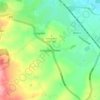
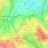
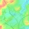
Elford topographic map

Click on the map to display elevation.

About this map

Name: Elford topographic map, elevation, terrain.

Location: Elford, Lichfield, Staffordshire, England, United Kingdom (52.66623 -1.74581 52.71005 -1.69460)

Average elevation: 59 m

Minimum elevation: 45 m

Maximum elevation: 83 m

Staffordshire trails, hiking, mountain biking, running and outdoor activities

Other topographic maps

Click on a map to view its topography, its elevation and its terrain.
Watford Gap

United Kingdom > England > Staffordshire > Lichfield

Average elevation: 131 m

Fradley

United Kingdom > England > Staffordshire > Lichfield

Average elevation: 59 m

Chasetown

United Kingdom > England > Staffordshire > Lichfield

Average elevation: 155 m

Hopwas

United Kingdom > England > Staffordshire > Lichfield

Average elevation: 82 m

Streethay

United Kingdom > England > Staffordshire > Lichfield

Average elevation: 73 m

Handsacre

United Kingdom > England > Staffordshire > Lichfield

Average elevation: 74 m

Croxall

United Kingdom > England > Staffordshire > Lichfield

Average elevation: 57 m

Little Aston

United Kingdom > England > Staffordshire > Lichfield

Average elevation: 142 m

Edingale

United Kingdom > England > Staffordshire > Lichfield

Average elevation: 63 m

Beacon Park

United Kingdom > England > Staffordshire > Lichfield

Average elevation: 93 m

Lynn

United Kingdom > England > Staffordshire > Lichfield > Stonnall

Average elevation: 128 m

Gentleshaw

United Kingdom > England > Staffordshire > Lichfield > Longdon

Average elevation: 174 m

Armitage

United Kingdom > England > Staffordshire > Lichfield

Average elevation: 80 m

Aldershawe

United Kingdom > England > Staffordshire > Lichfield

Average elevation: 102 m

Pipehill

United Kingdom > England > Staffordshire > Lichfield > Woodhouses

Average elevation: 111 m

Watford Gap

United Kingdom > England > Staffordshire > Lichfield

Average elevation: 131 m

Watford Gap

United Kingdom > England > Staffordshire > Lichfield

Average elevation: 131 m

Handsacre

United Kingdom > England > Staffordshire > Lichfield

Average elevation: 77 m

Gear up for your next adventure:

🧼Biodegradable Soap - Leave-no-trace hygiene for multi-day mountain treks
🌂Windproof Trekking Umbrellas - Surprising but effective rain protection on low-wind trails
📷Camera Straps - Secure straps for carrying cameras while walking
🥤Collapsible Water Bottles - Save space in your rucksack as you consume your water
🧵Survival Paracord - Multi-purpose cordage for emergency repairs and shelters

As an Amazon Associate, this site earns from qualifying purchases at no extra cost to you.