Geolocate

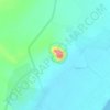
Karima topographic map

Click on the map to display elevation.

About this map

Name: Karima topographic map, elevation, terrain.

Location: Karima, Merwoe مروي, Northern State, Sudan (18.50513 31.80762 18.58513 31.88762)

Average elevation: 266 m

Minimum elevation: 245 m

Maximum elevation: 353 m

Other topographic maps

Click on a map to view its topography, its elevation and its terrain.
Gear up for your next adventure:

👕Technical Hiking Tees - Moisture-management for high-exertion climbs
🗺️Ordnance Survey Maps - Essential paper maps for hiking across the UK national parks
📦Dry Bags - Waterproof bags to protect gear from rain
🚲Bikepacking Frame Bags - Storage for tools and navigation gear on long off-road rides
🧼Camping Hygiene Kits - Compact hygiene essentials for outdoor stays

As an Amazon Associate, this site earns from qualifying purchases at no extra cost to you.