
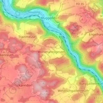
Wohlmannsgesees topographic map
Interactive map
Click on the map to display elevation.
About this map
Name: Wohlmannsgesees topographic map, elevation, terrain.
Average elevation: 439 m
Minimum elevation: 301 m
Maximum elevation: 531 m
Other topographic maps
Click on a map to view its topography, its elevation and its terrain.
Birkenreuth
Deutschland > Bayern > Landkreis Forchheim > Wiesenttal
Birkenreuth, Wiesenttal, Landkreis Forchheim, Bayern, 91346, Deutschland
Average elevation: 440 m
Trainmeusel
Deutschland > Bayern > Landkreis Forchheim > Wiesenttal
Trainmeusel, Wiesenttal, Landkreis Forchheim, Bayern, 91346, Deutschland
Average elevation: 433 m