Geolocate

Siedlec topographic map

Interactive map

Click on the map to display elevation.

About this map

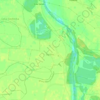
Name: Siedlec topographic map, elevation, terrain.

Location: Siedlec, gmina Radłów, Tarnów County, Lesser Poland Voivodeship, Poland (50.06991 20.85558 50.08328 20.89898)

Average elevation: 184 m

Minimum elevation: 173 m

Maximum elevation: 188 m

Other topographic maps

Click on a map to view its topography, its elevation and its terrain.

Piotrkowice

Poland > Lesser Poland Voivodeship > Tarnów County

Piotrkowice, gmina Tuchów, Tarnów County, Lesser Poland Voivodeship, Poland

Average elevation: 286 m

Dwudniaki

Poland > Lesser Poland Voivodeship > Tarnów County > Wierzchosławice

Dwudniaki, Wierzchosławice, gmina Wierzchosławice, Tarnów County, Lesser Poland Voivodeship, 33-122, Poland

Average elevation: 192 m

Skała

Poland > Lesser Poland Voivodeship > Tarnów County > Koszyce Małe

Skała, Koszyce Małe, gmina Tarnów, Tarnów County, Lesser Poland Voivodeship, 33-111, Poland

Average elevation: 231 m

Żabno

Poland > Lesser Poland Voivodeship > Tarnów County

Żabno, gmina Żabno, Tarnów County, Lesser Poland Voivodeship, 33-240, Poland

Average elevation: 186 m