Geolocate

Pontypridd topographic map

Click on the map to display elevation.

About this map
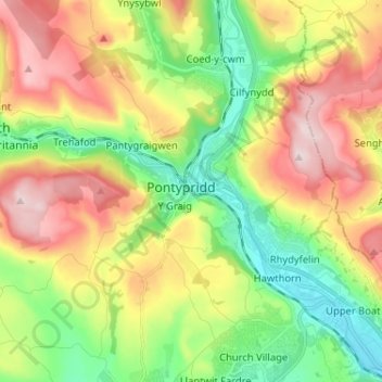
Name: Pontypridd topographic map, elevation, terrain.

Location: Pontypridd, Rhondda Cynon Taf, Wales, CF37 1LE, United Kingdom (51.56010 -3.38494 51.64010 -3.30494)

Average elevation: 184 m

Minimum elevation: 37 m

Maximum elevation: 380 m

Rhondda Cynon Taf trails, hiking, mountain biking, running and outdoor activities

Gear up for your next adventure:

📐Altimeters & Barometers - Tools for measuring altitude and air pressure
👕Merino Base Layers - Natural temperature regulation for cold weather hiking and camping
🥤Hiking Water Bottles - Reusable bottles for hydration on the trail
💧Hydration Reservoirs - Convenient water bladders for hands-free drinking on the move
🦶Anti-Blister Balms - Protect your feet before long topographic expeditions

As an Amazon Associate, this site earns from qualifying purchases at no extra cost to you.