
Carita topographic map
Interactive map
Click on the map to display elevation.
About this map
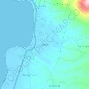
Name: Carita topographic map, elevation, terrain.
Location: Carita, Pandeglang, Banten, Java, 42264, Indonesia (-6.35926 105.79710 -6.27926 105.87710)
Average elevation: 47 m
Minimum elevation: -1 m
Maximum elevation: 475 m
Other topographic maps
Click on a map to view its topography, its elevation and its terrain.