
Gunung Wilis topographic map
Interactive map
Click on the map to display elevation.
About this map
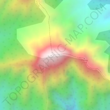
Name: Gunung Wilis topographic map, elevation, terrain.
Location: Gunung Wilis, Tulungagung, East Java, Indonesia (-7.86585 111.80335 -7.86575 111.80345)
Average elevation: 1,693 m
Minimum elevation: 1,309 m
Maximum elevation: 2,159 m