
Thank you for supporting this site ❤️
Make a donation
Make a donation
Gear up for your next adventure:
As an Amazon Associate, this site earns from qualifying purchases at no extra cost to you.
Lenzari topographic map
Click on the map to display elevation.
Thank you for supporting this site ❤️
Make a donation
Make a donation
Gear up for your next adventure:
As an Amazon Associate, this site earns from qualifying purchases at no extra cost to you.
About this map
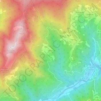
Name: Lenzari topographic map, elevation, terrain.
Location: Lenzari, Vessalico, Provincia di Imperia, Liguria, Italy (44.04474 7.93920 44.08474 7.97920)
Average elevation: 557 m
Minimum elevation: 143 m
Maximum elevation: 1,095 m
Thank you for supporting this site ❤️
Make a donation
Make a donation
Gear up for your next adventure:
As an Amazon Associate, this site earns from qualifying purchases at no extra cost to you.