Geolocate

Hinton topographic map

Click on the map to display elevation.

About this map

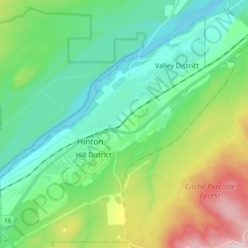
Name: Hinton topographic map, elevation, terrain.

Location: Hinton, Town of Hinton, Alberta, T7V 1A0, Canada (53.35905 -117.62868 53.43905 -117.54868)

Average elevation: 1,072 m

Minimum elevation: 951 m

Maximum elevation: 1,392 m

Gear up for your next adventure:

🧢Thermal Beanie Hats - Prevent heat loss from the head in windy summit conditions
📦Dry Bags - Waterproof bags to protect gear from rain
🚶Walking Pedometers - Simple distance tracking for casual trail walkers
🥾Hiking Boots - Waterproof and durable boots for long-distance hiking in the UK
🧭Orienteering Compasses - Accurate compasses for map-based navigation

As an Amazon Associate, this site earns from qualifying purchases at no extra cost to you.