
Gehlour Ghati topographic map
Interactive map
Click on the map to display elevation.
About this map
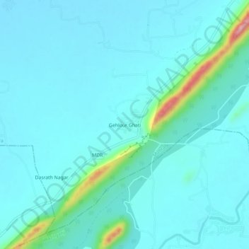
Name: Gehlour Ghati topographic map, elevation, terrain.
Location: Gehlour Ghati, Muhra, Gaya, Bihar, India (24.85944 85.21928 24.89944 85.25928)
Average elevation: 111 m
Minimum elevation: 85 m
Maximum elevation: 291 m