
Thank you for supporting this site ❤️
Make a donation
Make a donation
Gear up for your next adventure:
As an Amazon Associate, this site earns from qualifying purchases at no extra cost to you.
Mullaca topographic map
Click on the map to display elevation.
Thank you for supporting this site ❤️
Make a donation
Make a donation
Gear up for your next adventure:
As an Amazon Associate, this site earns from qualifying purchases at no extra cost to you.
About this map
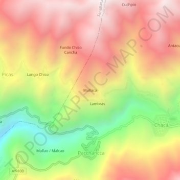
Name: Mullaca topographic map, elevation, terrain.
Location: Mullaca, Chaca, Huanta, Ayacucho, Perú (-12.79671 -74.24208 -12.75671 -74.20208)
Average elevation: 3,650 m
Minimum elevation: 2,863 m
Maximum elevation: 4,263 m
Thank you for supporting this site ❤️
Make a donation
Make a donation
Gear up for your next adventure:
As an Amazon Associate, this site earns from qualifying purchases at no extra cost to you.