
Deer Park topographic map
Interactive map
Click on the map to display elevation.
About this map
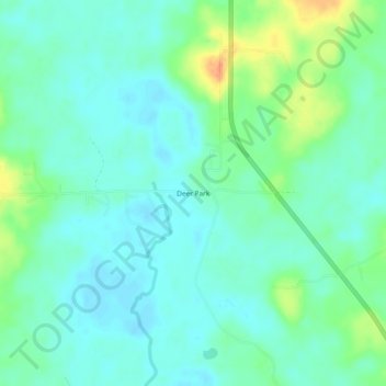
Name: Deer Park topographic map, elevation, terrain.
Location: Deer Park, Washington County, Alabama, United States (31.19684 -88.33723 31.23684 -88.29723)
Average elevation: 48 m
Minimum elevation: 36 m
Maximum elevation: 79 m
Other topographic maps
Click on a map to view its topography, its elevation and its terrain.
Walley
United States > Alabama > Washington County
Walley, Washington County, Alabama, United States
Average elevation: 73 m
Chatom
United States > Alabama > Washington County
Chatom, Washington County, Alabama, 36518, United States
Average elevation: 48 m
Tibbie
United States > Alabama > Washington County > Tibbie
Tibbie, Washington County, Alabama, 36583, United States
Average elevation: 55 m
McIntosh
United States > Alabama > Washington County > McIntosh
McIntosh, Washington County, Alabama, United States
Average elevation: 13 m
Carson
United States > Alabama > Washington County
Carson, Washington County, Alabama, 36548, United States
Average elevation: 18 m