
Kumaga topographic map
Interactive map
Click on the map to display elevation.
About this map
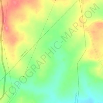
Name: Kumaga topographic map, elevation, terrain.
Location: Kumaga, Konshisha, Benue State, Nigeria (7.38000 8.58000 7.42000 8.62000)
Average elevation: 179 m
Minimum elevation: 137 m
Maximum elevation: 225 m
Other topographic maps
Click on a map to view its topography, its elevation and its terrain.
Azer
Nigeria > Benue State > Konshisha > Azer
Azer, Konshisha, Benue State, Nigeria
Average elevation: 119 m