Geolocate

Fulton topographic map

Click on the map to display elevation.

About this map

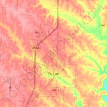
Name: Fulton topographic map, elevation, terrain.

Location: Fulton, Callaway County, Missouri, 65251, United States (38.81534 -91.98629 38.91541 -91.91637)

Average elevation: 246 m

Minimum elevation: 176 m

Maximum elevation: 275 m

Other topographic maps

Click on a map to view its topography, its elevation and its terrain.

Readsville

United States > Missouri > Callaway County

Average elevation: 245 m

Gear up for your next adventure:

🧥Waterproof Hiking Jackets - Rain protection for walking in all weather conditions
🧵Survival Paracord - Multi-purpose cordage for emergency repairs and shelters
👕Merino Base Layers - Natural temperature regulation for cold weather hiking and camping
🧣Neck Gaiters - Versatile protection against wind and cold
🪓Outdoor Multitools - Versatile tools for hiking and camping

As an Amazon Associate, this site earns from qualifying purchases at no extra cost to you.