
Ebracher Forst topographic map
Interactive map
Click on the map to display elevation.
About this map
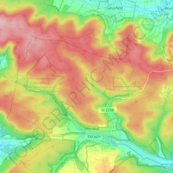
Name: Ebracher Forst topographic map, elevation, terrain.
Location: Ebracher Forst, Landkreis Bamberg, Bayern, Deutschland (49.84725 10.44439 49.87877 10.52696)
Average elevation: 394 m
Minimum elevation: 305 m
Maximum elevation: 476 m