
Thank you for supporting this site ❤️
Make a donation
Make a donation
Gear up for your next adventure:
As an Amazon Associate, this site earns from qualifying purchases at no extra cost to you.
Townsend topographic map
Click on the map to display elevation.
Thank you for supporting this site ❤️
Make a donation
Make a donation
Gear up for your next adventure:
As an Amazon Associate, this site earns from qualifying purchases at no extra cost to you.
About this map
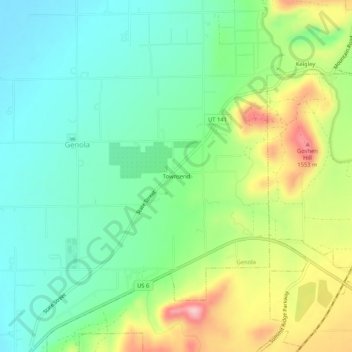
Name: Townsend topographic map, elevation, terrain.
Location: Townsend, Genola, Utah County, Utah, 84655, United States (39.97273 -111.84855 40.01273 -111.80855)
Average elevation: 1,438 m
Minimum elevation: 1,371 m
Maximum elevation: 1,568 m
Thank you for supporting this site ❤️
Make a donation
Make a donation
Gear up for your next adventure:
As an Amazon Associate, this site earns from qualifying purchases at no extra cost to you.